February 22, 2026
11:37 AM
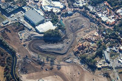
In foreground is the work site of Piston Peak National Park, as seen from Tiana's Bayou Adventure.
In background is scrim over scaffolding at The Haunted Mansion exterior refurbishment.
Opposite viewpoint of the aerial photo in first Post of this Thread.
February 14, 2026
1:43 AM
Wider aerial view of the Piston Peak National Park construction site.
February 14, 2026
1:39 AM
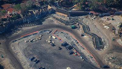
Aerial overview of construction of Piston Peak National Park.
First concrete forms for the ride route are seen winding near guest walkways (which are behind scaffolding for now).
The route at right is lower than the Big Thunder Mountain railroad area.
February 14, 2026
1:34 AM
Aerial look at first concrete forms for the ride route of Piston Peak National Park.
February 14, 2026
1:27 AM
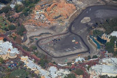
Aerial photo of the Piston Peak National Park construction site relative to Frontierland and Liberty Square.
First concrete forms for the ride route are seen winding near center of this photo.
February 14, 2026
1:21 AM
Aerial photo of some of the current elevation changes in the Piston Peak National Park construction site. Slopes at top and at right for access to this plateau.
February 14, 2026
1:10 AM
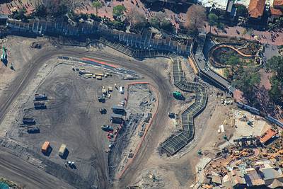
Aerial overview of construction at Piston Peak National Park. First concrete forms for the winding ride route at left.
Haunted Mansion, at right, is behind tall scrims for an exterior refurbishment. The attraction is open.
February 14, 2026
1:04 AM
Aerial look at the development of the Piston Peak National Park ride route near Big Thunder Mountain Railroad.
The route is lower elevation and might be hidden in this area behind landscaping. Some rebar in the concrete forms is vertical.
February 14, 2026
12:55 AM
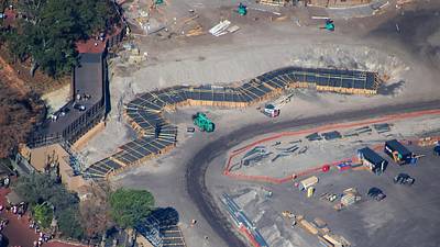
In this aerial photo of Piston Peak National Park construction, elevation difference can be seen between concrete forms (with rebar) and terrain near Big Thunder Mountain Railroad.
Easy to imagine guests looking through trees at the attraction from the bridge at left.
February 14, 2026
12:47 AM
Aerial overview of concrete forms (with rebar). For the first foundations of the Piston Peak National Park ride route.
February 13, 2026
11:56 PM
Aerial overview of the development of Villains land and Piston Peak National Park.